
…A STRONG THUNDERSTORM WILL AFFECT NORTHWESTERN ST. BERNARD…
SOUTHWESTERN ORLEANS AND NORTHWESTERN JEFFERSON PARISHES…
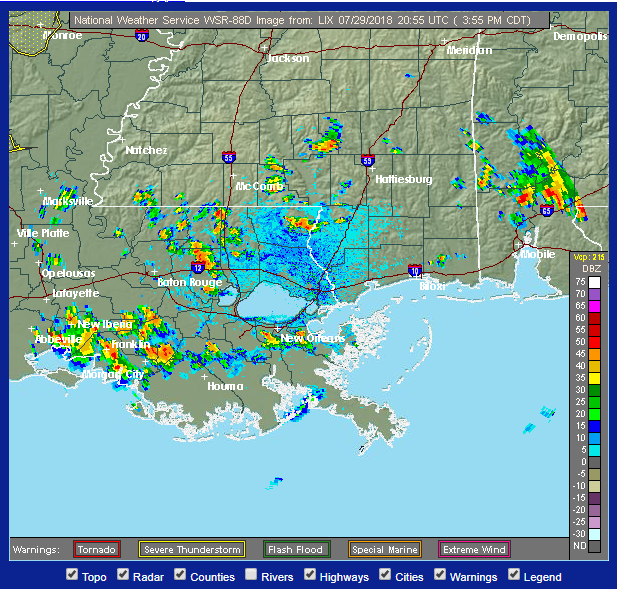
At 334 PM CDT, a strong thunderstorm was located over Westwego,
Bridge City and Marrero. The storm is nearly stationary, but should
drift north around 5 mph towards the east bank of the river.
Winds in excess of 30 mph are possible with this storm.
Locations impacted include…
New Orleans, Metairie, Marrero, Harvey, Avondale, Timberlane,
Chalmette, Belle Chasse, Jefferson, Gretna, Harahan, Westwego,
Woodmere, Elmwood, Terrytown, Bridge City, River Ridge, Estelle,
Waggaman and Arabi.
Torrential rainfall is also occurring with this storm, and may cause
localized flooding. Do not drive your vehicle through flooded
roadways.
Frequent cloud to ground lightning is occurring with this storm.
Lightning can strike 10 miles away from a thunderstorm. Seek a safe
shelter inside a building or vehicle.
Hazardous Weather Outlook
National Weather Service New Orleans LA
1124 AM CDT Sun Jul 29 2018
This Hazardous Weather Outlook is for portions of Southeast
Louisiana…South Mississippi and the adjacent coastal waters.
.DAY ONE…This Afternoon and Tonight
Scattered thunderstorms are expected today, especially during the
afternoon and evening hours. Some of the thunderstorms will be
capable of producing frequent lightning, gusty winds, and heavy
downpours of rain.
.DAYS TWO THROUGH SEVEN…Monday through Saturday
Scattered to numerous thunderstorms are expected each day. A few
of these storms could become strong and produce frequent
lightning, gusty winds, and heavy downpours of rain. In addition,
locally heavy rainfall could result in ponding of water in low
lying and poorly drained areas.
